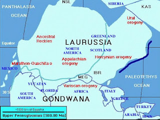
 http://www.geocraft.com/WVFossils/Penn_planimetric_map.html
Planimetric maps are maps that that show only the horizontal positions of the representation. There is no topographic relief in planimetric maps, although features such as rivers, boundaries, and large bodies of water (as seen in this map) are represented. This particular planimetric map represents what a large part of the earth may have looked like 300 million years ago.
No comments:
Post a Comment