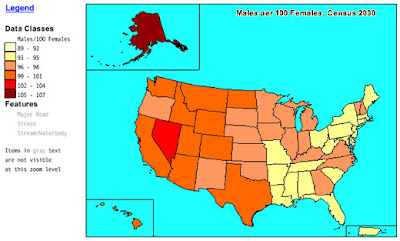
Chloropleth maps use different colors to convey values of a particular set of data to the reader. These maps are based on predefined units of land. States are shown in this particular map, but chloropleth maps of counties and cities are common as well. This map represents the ratio of males to females from the U.S. Census Bureau in 2000. This map can also be classified as planimetric and thematic.
No comments:
Post a Comment