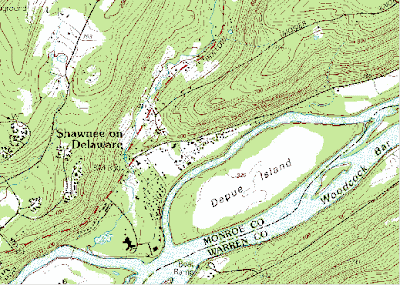
 Digital Raster Graphs (DRG) maps are scanned images from USGS topographic maps. The map shown here is a DRG map of Bushkill, PA. The contour lines represent topographic information, and I assume the green shading represents vegetation while the white shading represents sand, or a lack of vegetation. This map is also topographic and an isoline map.
http://www.google.com/imgres?imgurl=https://www.e-education.psu.edu/files/geog482/image/drg_bushkill_sw.gif&imgrefurl=https://www.e-education.psu.edu/natureofgeoinfo/c6_p6.html&usg=__CJVhpkuO84UI7kbKi4knaZNZJZE=&h=370&w=519&sz=30&hl=en&start=4&itbs=1&tbnid=mZF37nXDl4YNOM:&tbnh=93&tbnw=131&prev=/images%3Fq%3Ddigital%2Braster%2Bgraph%26hl%3Den%26gbv%3D2%26tbs%3Disch:1
No comments:
Post a Comment